All Day Saturday & Sunday
SUNDAY NO. A1003-??? July 4
Chattooga River Gorge
(strenuous)
Hike 6, Drive 120, ?? ft. ascent, Rated ??
Ted Snyder, 864-638-3686, tedsnyderjr@bellsouth.net
*Form carpools at Westgate, and meet leader at Toxaway Post Office (turn right from US 64 to NC 281 north and go 1.5 miles) at 9:30 AM.
I will lead a hike in the Chattooga River through the Rock Gorge. This is a wading hike, but in the full, fully watered stream. The river is mostly wide, so only about ankle deep. There is some rock scrambling in the throat of the gorge, and we have to climb the face of two small waterfalls, easy ones. Wonderful swimming holes. Walking stick a necessity. Need dry shoes for the hike out on the Foothills Trail. There will be at least two swimming stops. Most of the Chattooga hike will be in the middle of the river. About three miles of river and three miles of trail hiking. Topos: Big Ridge, Lake Toxaway
Awesome Fourth of July celebration greets hikers in the Rock Gorge of the Chattooga River. In a departure from custom, members of this trip walked on the river bottom rather than on a trail. Swimming holes were encountered frequently, as well as spectacular scenery, and big boulders to climb over. New skills were developed in swift river crossing, and climbing waterfalls. For a more complete report click here.--Ted Snyder
SUNDAY NO. A1003-420 July 4
Allen Gap to Tanyard Gap 9:00 AM
(moderate)
Hike 8.8, Drive 85, 2100 ft. ascent, Rated A-A
Tish Desjardins, 828-656-2191, desraylet@aol.com
LTC *Form carpools at Westgate, and meet leader at US25/NC208 intersection at 9:45 AM. After the hike there will be a potluck supper in the nearby Bear River Community Lodge. Hikers are requested to contribute food for the supper. Food will be taken to a refrigerator before the hike. Please phone the leader to coordinate what food to bring. Hike from Allen Gap to Tanyard Gap on the AT with a stop at the Rich Montain lookout tower. Topos: Hot Springs; also NatGeo map #782
The actual hike that the eight of us did was on the A.T. from Tanyard Gap to Allen Gap including the Rich Mtn. tower. Total miles was 9 1/4. It was a good hike with nice views from the tower. After, we enjoyed a nice summer pot luck barbeque at the club house where I live near by (barbequed chicken, sausages, corn on the cob, potato salad, garden salad, rice salad, seafood salad, 4th. of July decorated cake, watermelon, and a nice cold beer). (We need to do another hike and work it off!!!)--Tish Desjardins
SATURDAY NO. A1003-076 July 10
Craggy to Little Snowball 10:00 AM
Hike 7.2, Drive 40, 2600 ft. ascent, Rated B-AA
Brenda Worley, 828-684-8656, clworley@bellsouth.net
From Bee Tree Gap, we’ll take the Snowball trail to High Rocks (Hawkbill Mtn.), with its views, and then on to the old lookout site atop Little Snowball, with its great views. Return via the same route. Second meeting place: Craven Gap at 10:20 AM. Topo: Craggy Pinnacle; also USFS South Toe River, Mt. Mitchell & Big Ivy Trail Map
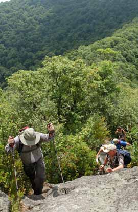 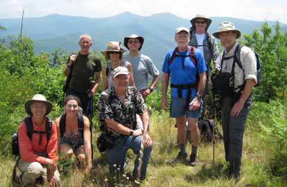
Photos by Ted Connors and Brenda Worley
Nine people showed up for this beautiful hike. The temperature was in the low 70's. The abundant sunshine afforded beautiful views from Hawkbill Rock and Little Snowball tower site. Turk's-cap Lilys were blooming and about 5' tall. We also saw a small bunch of Blue Bead Lily with the dark blue fruit. We got on the trail at 11AM and got back to the cars a little before 4PM.--Brenda Worley
SUNDAY NO. A1003-531 July 11
Pisgah Inn to Beaverdam Overlook *9:00 AM
Ashok Kudva, 828-698-7119, ashok.kudva@att.net
Hike 7.9, Drive 50, 1250 ft. ascent, rated B-B
P400 *Form carpools at Westgate, and meet leader at Pisgah Inn parking lot near convenience store at 9:45 AM. Enjoy the mountain views along the mst from Pisgah Inn to the Beaver Dam Overlook. After Little Pisgah Mtn, it’s downhill almost all the way. Look for the giant Turk’s Cap lilies near the big funny tree. Car shuttle. Topos: Cruso, Dunsmore Mt.; also MST Profiles book, pg. 42-45
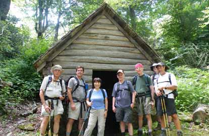 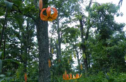
Photos by Ashok Kudva
Having been on an antibiotic treatment all week to fight a cough , I was unsure of my ability to lead the hike. When seven smiley hikers greeted me at the Pisgah Inn, it cleared most of the doubts! I dropped my car at the Mills River Valley Overlook as an early exit option for me in the car shuttle plan.
We briefly paused at the historic Buck Spring Lodge site. Several hikers commented on the excellent trail condition. I promised to pass the feedback to Pete Petersen’s Friday Pisgah Crew. We went off the trail to the only complete structure left from the historic Vanderbilt site, the springhouse, cited in Walt Weber’s book. Since none of them had seen it before, they eagerly inspected it in and out. Builder Kevin and architect Steve compared the roof shingles from the 1880 era to the current asphalt shingles!
During the ascent to Little Mt. Pisgah, the only serious ascent of the hike, strong hikers proceeded ahead of me at my request. We saw many Trout Lilies (see photo). At Mills River Valley Overlook we paused for lunch. A cooler in my car had cold apple juice which we shared. Carroll shared some human interest stories from this year’s hiking trip to Europe. The hike and camaraderie had invigorated my respiratory system and I was having a great time with the folks. Mountain views were spectacular in 360 degree directions. I did not take the early exit option and finished the hike with the Magnificent Seven--Ashok Kudva
SUNDAY NO. A1003-067 July 18
Douglas Falls & Craggy Gardens *9:00 AM
Hike 8, Drive 45, 1200 ft. ascent, Rated B-B
Charlie Ferguson, 828-625-2677, ccf108@gmail.com
WC100 *The only meeting location will be the back parking lot of the Folk Art Center. From the Craggy Garden Visitor Center we’ll hike the MST down to the trail to Douglas Falls. The falls are quite high and should have a good amount of water after a rain. We’ll hike back the way we came and on to the Craggy Gardens Picnic area, up to the top which was recently cleared to make more open views, and back to the cars at the Visitor Center. There is an option for people to do just the falls for a 5.6-mile hike. Second meeting place: Craven Gap at 9:10 AM. Topos: Craggy Pinnacle, Montreat; also FS Big Ivy map
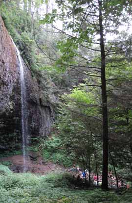 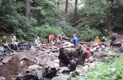
Photos by Charlie Ferguson
Seventeen hikers gathered at the Craggy Gardens Visitor Center. It was explained that the hike was more difficult than originally advertised. There was more steep climbing and descending and about half of the trail was very rough and rocky. Everyone was still up for it so we left about 10:00 AM, starting on the MST. After about a mile of tricky footing we turned left onto the Douglas Falls trail and added high stinging nettle to the fun descent. After another mile the trail got less steep and we could actually look around at some old growth trees that were left standing. We got to the falls about 12:30 and had a leisurely lunch there. We got distracted by one of the several side trails near the falls but quickly found our way back up to our trail back. When we got back to the visitor center, clouds were moving in and starting to cover the top of Craggy Gardens. People felt a little rain. We ended the hike without climbing to Craggy Gardens because the views were obscured.--Charlie Ferguson
SATURDAY NO. A1003-697 July 24
Silers Bald 8:00 AM
Hike 9, Drive 160, 1800 ft. ascent, Rated A-A
Jeff McGurk, 864-921-6469, jbsbestfan@hotmail.com
900M, SB6K From the Clingman’s Dome parking lot, we will hike to the grassy meadow of Silers Bald. The ridgeline trail offers wonderful views, at one point only a few feet wide with dropoffs on either side. We’ll return via the same route, with a visit to the summit of Clingman’s Dome, the highest point on the AT. Second meeting place: Maggie Valley Post Office at 8:30 AM, but contact leader first Topos: Clingman’s Dome, Silers Bald; also NatGeo maps #229 and #317
We had a fun and diverse group hike for the Siler's Bald hike. When people learned I was leading, they came from all over the country to participate. We had Angela from Michigan, Gail from Charlotte, and Ozzie and Rick from Miami. All kidding aside, it was a fun group and nice hike that is clearly harder than it seems on paper. Stuart was good enough to run sweep and also logged the elevation. He came up with about a 2,400 foot elevation gain and a 9.4 mile distance. The weather cooperated mostly and stayed just below 80 degrees. (which is high for the elevation I guess) After a brief rest at Siler's Bald we returned for the wonderful views from Clingman's Dome. We saw many hikers and backpackers along the way. Thanks to Bruce Bente for setting me up with this hike.--Jeff McGurk
SUNDAY. NO. A1003-475 July 25
Hump Mountain from Yellow Mtn. Gap *8:30 AM
Hike 9, Drive 140, 2400 ft. ascent, Rated A-AA
Lisa Hart, 828-450-6986, tiw.south@gmail.com
We will hike from Roaring Creek Road to Yellow Mountain Gap at which point we join the AT, along an open ridge to Little Hump Mtn. and on to Hump Mtn. where we’ll have lunch on a grassy bald at 5587 ft. We’ll return to Yellow Mtn. Gap and take the Overmountain Victory Loop back to the cars. The fabulous vistas and open meadows make the drive and moderately strenuous hike very much worth while. Topos: Carvers Gap, White Rocks Mtn.; also NatGeo map #783
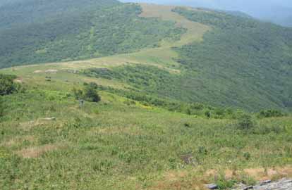
Photo by Lisa Hart
A road detour in Plumtree delayed the start to a hot day. Thirteen hikers headed out to the A.T. shelter at Yellow Gap (the only A.T. shelter in a barn) before the steep, hot ascent to Little Hump Mt. Everyone was refreshed at break-time in the open meadow with steady breezes. Then it was off to Hump Mt. along the new section of the A.T. for lunch and more spectacular views. Along the way, the infamous Bradley Gap campsite was pointed out to Bob and Bob. The deep descent down the balds was remarkable with the 360 views. A couple of hikers (with permission, of course), took the old A.T. route and met the group at the break spot. The group enjoyed the views and breezes on the balds, then headed back to Asheville for a fun dinner. --Lisa Hart
SUNDAY NO. A1003-572 Aug. 1
Duck Hawk Rock (Bernard Elias Favorite Hike series #4) *8:00 AM
(strenuous)
Hike 10, Drive 150, 3000 ft. ascent, Rated A-AA
Ted Snyder, 864-638-3686, tedsnyderjr@bellsouth.net
SB6K, 900M *Form carpools at Westgate, and meet leader at Oconaluftee Visitor Center at 9:15 AM. Duck Hawk was an earlier name for the Peregrine Falcon. Peregrine Peak is atop Alum Cave Bluffs. Big Duck Hawk Rock is part of a knife-edge ridgeline that slants down across from Alum Cave. From Alum Cave Trail we will get a view of the (closed) Big Duck Hawk Rock and the holes in it. As a compromise since we cannot hike to Duck Hawk Rock, we will hike to Mt. LeConte (6593 ft.), visit Cliff Top, then retrace our steps. Topo: Mt. LeConte; also NatGeo map #317
Five hikers met in Asheville, and with the leader made a trip contingent of six.
Pouring rain at Westgate. High broken clouds at Oconaluftee Visitor Center. High clouds breaking up in wind and clearing at lunch time. Good views, except highest ridge tops still in clouds. Clear with a few white puffballs at end of trip.
This trip was the usual Mt. LeConte up-and-back. Lots of other hikers. Cloud cover kept it cool on the hike up to the top. Stopped for views of Duck Hawk Ridge (closed to hikers to protect Peregrine Falcon). Stopped for history lesson at Gracie’s Pulpit. Had a leisurely lunch at Cliff Top.--Ted Snyder
SUNDAY NO. A1003-242 Aug. 1
Sam Knob – Devil’s Courthouse Loop 8:30 AM
(Moderate)
Hike 8.5, Drive 75, 1500 ft. ascent, Rated B-B
Becky Smucker, 828-231-2198, bjsmucker@gmail.com
SB6K, P400 This hike in the cool high elevations is perfect for a hot summer day. From FS 816 we will ascend Sam Knob (6040 ft.) with its 360 degree views, then hike through high meadows on the Flat Laurel and Little Sam Trails and the MST via Devil’s Courthouse (with its great views). We then return via the MST across FS 816 and up to the summit of Black Balsam (6214 ft.), then down to our cars. Second meeting place: BRP Cold Mtn. Overlook at 9:20 AM. Topo: Sam Knob; also NatGeo map #780
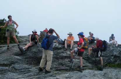 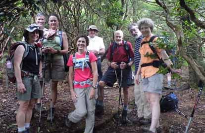
Photos by Ashok Kudva
Because we paid proper respect to the powers that be (according to Ken Schroeder’s entertaining rendition of Cherokee legend), the weather defied the forecast and gave us a beautiful day with plenty of cloud drama. This loop is so interesting because of varied settings and the ability to see from high and open points where you’re going and where you’ve come from. We grazed on a never-ending supply of blackberries and blueberries as we walked, and enjoyed the many summer plants in bloom, including three species of orchid and many meadow flowers. At lunch, Dwight McCarter recounted several of his rescue events in the Smokies. Several of the group bagged three new SB6K peaks. That morning, many of us had left our homes in a downpour, and within one minute of leaving the parking lot at the end of the day, we hit heavy fog. We felt lucky to have had such an unexpected window of lovely weather for our hike. Note: The first photo is Ken Schoeder sharing Cherokee legends, and the second the SB6K triple-peak baggers.--Becky Smucker
SUNDAY NO. A1003-267 Aug. 8
Horsepasture River 8:00 AM
Hike 8, Drive 105, 2000 ft. ascent, Rated B-A
Kathleen Hannigan, 828-230-4883, kathleen.hannigan@pgnmail.com
Swimming hike! Come to see the recently re-opened Gorges State Park area. We’ll hike down alongside the Horsepasture River to see the waterfalls – Drift, Turtleback, Rainbow and Stairway, ending at Windy, the final waterfall downstream near Lake Jocassee. One or more swimming breaks will be taken. Second meeting place: Pisgah Forest Bi-lo at 8:35 AM. Topo: Reid; Also Sierra Club guide to Jocassee Gorges.
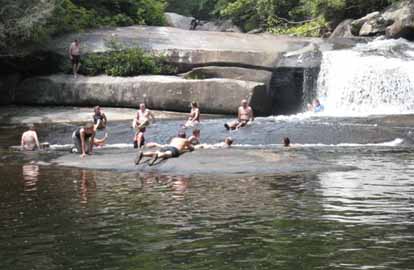
Photo by Kathleen Hannigan
It was a Gorges day for a swim hike! 21 people showed up for hiking and swimming along the Horsepasture River in the Gorges State Park. It was already getting warm when we started out on the trail from the Gorges parking area, walking to Rainbow Falls. Always awesome for its size and volume of water, the leader reminded hikers that it should be respected for its danger as well. The river at the top of this falls appears very benign and is easily accessed from the trail. Deaths have occurred here. We continued our hike upriver to Turtleback Falls, where we could not resist getting in the water and trying the slide off Turtleback which so many visitors come here in the summer to enjoy. After that we took another short walk upriver to view Drift Falls, now on private property but still viewable from the public side. We then backtracked to a wonderful swimming hole downstream from Rainbow that features a small waterfall, according to ncwaterfalls.com is named Hidden Falls. There we ate lunch, swam, slid around on the rocks, got behind the waterfall, and generally just had a great time. Since enthusiasm for the long side trip to Windy Falls had waned, we wrapped up our waterfall viewing by hiking down to Stairway Falls, where of course we had to get in for just a quick dip in the nice pool below the falls. We enjoyed feeling how warm the water was as it dropped into the pool, having been warmed by the sun as it traveled over the many rock ledges that give Stairway its name. After the return trip to Brevard, some of the hikers ended the day by another dip in the river behind the Sycamore Flats picnic area in Pisgah Forest and then headed to Dugan’s to toast yet another fine day’s hike!--Kathleen Hannigan
--Back to Top
Half Day Sunday
HALF-DAY NO. H1003-062 July 11
Daniel Ridge Loop Trail *12:15 PM
Hike 4, Drive 70, 800 ft ascent, Rated C-C
Nonmembers, call leader, Lucy Prim, 828-693-6580, 32lucette@gmail.com
P400 *Form carpools at Westgate, and meet leader at Fish Hatchery off FS 475 at 1:00 PM. This moderate loop hike has lots to “C”: Creeks, Chasms, and a Cool Cascade finale.
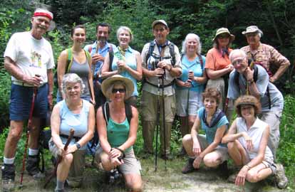
Photo by Lucy Prim
We had a very nice hike along Daniel Ridge Loop. Fourteen hikers did the walk and all went very well although we did have a close call with several bikers speeding down the path and having to quickly hop off their bikes so they wouldn't crash into us. Then we stopped walking and got out of the way and told them to continue their bike ride. They got on their bikes and began down the path, but suddenly one of them took a horrible crashing spill, just as he was passing our group. We gasped in horror, thinking he'd done some terrible injury to himself, but he hopped back up and got on his bike and went speeding away with a bloody nose. A couple of ladies passed us and warned us of a rattlesnake they'd seen just up the path. Dwight McCarter very kindly walked up by the front until we passed the place the snake was supposed to be. We walked along very warily, searching for the snake but luckily it was no where to be seen. The rest of the hike was peaceful and delightful.--Lucy Prim
HALF-DAY NO. H1003-349 July 18
Buck Spring Trail *12:30 PM
Hike 6.2, Drive 50, Rated B-C
Nonmembers, call leader, Jane Laping, 828-277-7342, janelaping@sbcglobal.net
P400 *Form carpools at Westgate, and meet hike leader at Pisgah Inn parking lot near convenience store at 1:15 PM. This pleasant downhill hike starts at the Pisgah Inn and ends at US 276. Car shuttle. MST Profiles book, pg. 40-41
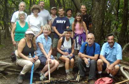
Photo by Jane Laping
Although the weather forecast called for rain, 15 fearless hikers set out from the Pisgah Inn on a partly cloudy afternoon. Turk’s cap lilies, Starry Campion, Black Cohosh, and Fire Pink greeted us as we started our 6 mile descent crossing at least seven streams and numerous rocky areas. A little more than halfway, we stopped at the only clearing on the trail for a delightful snack break with Dwight entertaining us with his endless stories. Shortly after leaving the clearing, we were hit with a deluge that covered the trail, soaked our parkas, and filled our boots. After about 20 minutes the rain stopped and we continued on the trail, passing through areas where it hadn’t rained at all. We eventually emerged from the woods and accounted for everyone, more tired and a lot wetter than when we had started.--Jane Laping
HALF-DAY NO. H1003-702 July 25
DuPont Forest: Buck Forest P.L.#1 *12:30 PM
Hike 5.6, Drive 94, 680 ft. ascent, Rated C-C
Nonmembers, call leader, Ashok Kudva, 828-698-7119, ashok.kudva@att.net
*Form carpools at Westgate, and meet leader at Pisgah Forest Bi-Lo at 1:05 PM. We’ll see spectacular High Falls, three lakes and the site of an old DuPont film manufacturing plant where once 1000 people worked. The leader, a local DuPont retiree, will explain the exclusive use of these recreational facilities for employees and customers and the uncertain times during real estate development efforts after the demise of manufacturing, which continued until DuPont State Forest was established to delight hikers and nature lovers. Topo: Sandstone Mountain; also DuPont State Forest Map, rev. 3/20/08
 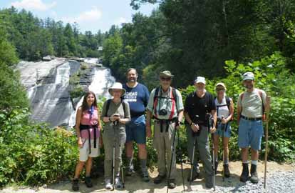
Photos by Ashok Kudva
Editors Note: Ashok included some brief and very interesting remarks on the DuPont operation. Click here to read them.
Eight hikers braved a 92 F sunny weather and assembled at the Buck Forest Access Area. Parking lots at the 3 access areas to the forest were full and cars had parked on both road shoulders. This is the most visited NC state forest.
We paused at the High Falls area at the shelter next to remnant chimney of a 1940 Buck Forest Lodge used as a hunting and fishing lodge by young Asheville professionals. I cited a colleague who survived a fall from the top to bottom of High Falls without a scratch! And, within a few months he was a witness at my naturalization hearing! We paused at Lake Dense, named for Jack Dense, a former DuPont plant manager, with the backdrop of Joanna Mountain. It was restricted for use by customers only. Lucy enjoyed a dip in the lake on a warm day! The last stop was at the edge of Lake Julia, named for the wife of Camp Summit owner. In 1980s DuPont purchased the camp property including a small airport. It was a good hike, but if we reschedule it during summer we should include optional swim!--Ashok Kudva
HALF DAY NO. H1003-043 Aug. 1
Frying Pan Tower *12:30 PM
Hike 4, Drive 50, Rated C-C
Nonmembers, call leader, Bobbi Powers, 828-667-5419, bobbipowers@live.com
P400 *Form carpools at Westgate, and meet leader at Pisgah Inn parking lot near convenience store at 1:15 PM. This is an easy in-and-out hike through a spectacular display of wild flowers to good views from the tower. MST Profiles book, pg. 40.
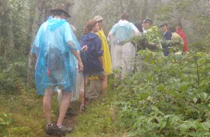
Photo by Jane Laping
The Pisgah Inn sat shrouded in a dense cloud – “thick as pea soup” – as 15 hikers gathered for the hike. We admired a dizzying array of wildflowers and butterflies along the trail from the campground as we headed toward Frying Pan Tower, stopping to don rain gear early on, but stopping again to remove it 20 minutes later. As we approached the fire tower from the forest service road, we were literally within 20 feet of the tower before it was visible. Just as we got out our snacks, rain began pounding down and stayed with us until we arrived at the Blue Ridge Parkway. We avoided a muddy return trip by walking back to the trail head via the Parkway. The day was warm, and no one was sweet enough to melt, so we agreed the gray, wet day had not prevented our having the interesting experience of hiking within the clouds.--Bobbi Powers
HALF-DAY No. H1003-465 Aug. 8
Flat Laurel Creek, Little Sam Knob, MST Loop 12:30 PM
Hike 6, Drive 80, 1000 ft. ascent, Rated B-B
Nonmembers, call leader, Marcia Bromberg, 828-505-0471, mwbromberg@yahoo.com
P400 Beginning at Sam Knob parking lot, hike Flat Laurel Creek Trail to Little Sam Knob Trail and enjoy views of Sam Knob and early blueberries. Turn up Sam Knob Trail with views of Little Sam and Mt. Hardy. Then head north on Mountains-to-Sea Trail, with great views into Pisgah Natl. Forest, to FS 816 and our cars. Second meeting place: BRP Cold Mtn. Overlook at 1:20 PM. MST Profiles book, pg. 34
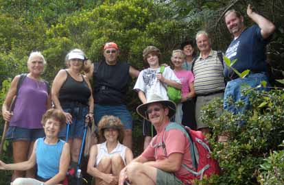
Photo by Marcia Bromberg
Our long drive up to the trailhead was rewarded for the 14 hikers with a pleasant, cool hike in the high country. We were a bit taken aback by all the cars parked along FR 816, both at the MST/Art Loeb crossing and at the parking lot, but the trails weren't crowded except with blackberries and blueberries. The hike leader was challenged to keep the hikers hiking rather than picking! We stopped the the large rock where the Little Sam Knob trail meets the MST to enjoy a snack and (what else) do some picking. At our second stop (where the picture was taken) we enjoyed the cloudy views of the Pisgah Forest valley below.--Marcia Bromberg
--Back to Top
WEDNESDAY NO. W1002-137 June 30
Carvers Gap to Grassy Ridge Bald, Roan Mtn. *8:00 AM
Hike 11.9 Drive 130, 2400 ft. ascent, Rated A-AA
Tish Desjardins , 828-656-2191,desraylet@aol.com
*Form carpools at Westgate, and meet leader at McDonald’s in Burnsville at 8:40 AM. Hike from Carvers Gap north on AT to Grassy Ridge side trail, then return on the AT to Roan High Knob and Roan High Bluff, and return to trail head. 360 degree panoramic views and flowers. Topo: Carvers Gap
Ten of us arrived at Carver's Gap at 9:45 and began the hike at 10:00. The hike ended at 5:00. It was a partly sunny to sunny day and temperatures were perfect--cool and enjoyable for hiking. We began on the A.T. north and switched to the Grassy Ridge Trail and had lunch at the end of that section at Grassy Ridge overlooking the gorgeous rolling green valleys. We returned on the same trail and observed Gray's Lillies, but, no rhododendrons or flaming azaleas as they bloomed very early this year. We also saw the goats taking a rest from their invasive woody plant munching and their masters, the dogs, were asleep on the job also.
We then headed south on the A.T. up to Roan High Knob and then onward to Roan High Bluff and back to Carver's Gap. There is plenty of construction work going on at the state park -- road repair, new rest rooms, road closures, etc. Great day!--Tish Desjardins
WEDNESDAY NO. W1003-504 July 7
Bull Gap to Lane Pinnacle 8:30 AM
Hike 10, Drive 30, 2900 ft. ascent, Rated A-AA
Tom Sanders, 828-252-632, tomary.avl@gmail.com
Hike on the MST from Bull Gap, past the Rattlesnake Lodge site, Rich Mountain, and up to good views from our lunch stop at Lane Pinnacle. Second meeting place: Bull Gap at 9:00 AM. Topo: Craggy Pinnacle; also MST Profiles book, pg. 56-59
The projected temperature was for over 90 degrees, which could have scared some away, but 14 people showed up for this hike. This was surprising because the distance was 10 miles and the elevation gain a strenuous 2900 ft. We began at Bull Gap and took our first break at Rattlesnake Lodge, noting the picture there of our deceased and much loved CMC member, Alan Barton. Then the real uphill began, to Rich Mtn, then several steep ups and downs to Lane Pinnacle where we had lunch. The views were very good, though the day was a bit hazy. The trail had not been weedeaten between Rich Mtn and Lane Pinnacle, and there are a lot of rocks there, but we went slowly. Everyone performed magnificantly and kept up. After lunch we returned the way we came. It never got above the low 80s, This is a very nice and strenuous hike, conveniently close to Asheville.--Tom Sanders
WEDNESDAY NO. W1003-289 July 14
Glassmine Overlook to Stepps Gap 9:00 AM
Hike 7, Drive 80, 2000 ft. ascent, Rated B-A
Paula Massey, 828-299-0226, massey.paula@gmail.com
SB6K A beautiful hike through an old balsam forest and some open views. Features two peaks over 6000, Blackstock Knob and Mt. Gibbes. This route has been worked out by Cave Dog and Tom Sanders, with a shortcut bushwhack off the MST around the north side of Potato Knob and on to Clingmans Peak and Gibbes. Car Shuttle. Topos: Mt. Mitchell, Montreat; also PNF S. Toe River, Mt. Mitchell & Big Ivy Trail Map and MST Profiles book, pg. 62-63
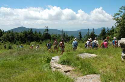 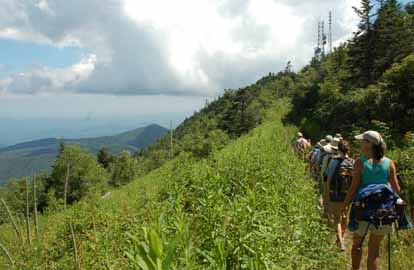
Photos by Ted Connors
This hike offered "something for everyone"! All twenty-two hikers enjoyed a sunny, but at times breezy day, enjoying the old balsam forest, beautiful Turk's Caps lilies and pink Turtleheads, scenic views, and two peaks over 6,000 feet (Blackstock Knob and Mt. Gibbes). And on top of all this we discovered the ruins of an old downed airplane, thanks to the investigative work of Charlie Ferguson, and witnessed the sudden flight of grouse and turkey. Oh, and after bushwhacking through the wilderness and waist high blackberry bushes, we came upon not one, but two cabins, near Mt. Gibbes-the newer one looked like a Swiss chalet!--Paula Massey
WEDNESDAY NO. W1003-246 July 21
Around Coffee Pot Mountain *9:00 AM
Hike 7.5, Drive 40, 1400 ft. ascent, Rated B-B
Charlie Ferguson, 828-625-2677, ccf108@gmail.com
P400 *Form carpools at Westgate, and meet leader at Trace Ridge Trailhead at 9:30 AM. We’ll circle Coffee Pot Mtn. by hiking up Trace Ridge Trail to Beaver Dam Gap on the BRP and returning on the Spencer Branch Trail, with a stop to see the Hendersonville Reservoir and dam. Topo: Dunsmore Mtn; also NatGeo map #780
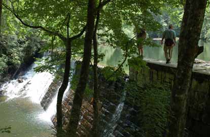 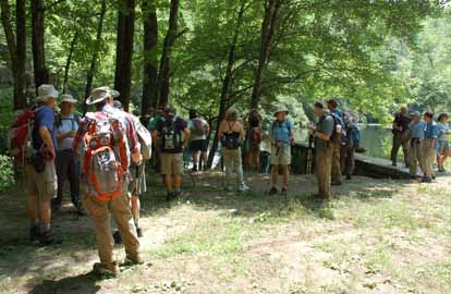
Twenty-one hikers collected at Westgate and the French Broad Overlook, drove south on the Parkway to Bent Creek Gap and down FS 5000, Wash Creek Rd. to the Trace Ridge Trailhead. We were honored by the presence of Sherman Stambaugh who is determined to hike when he is 90 (not too far away). We hiked up the gentle incline of the Trace Ridge trail and the very steep first part of the Spencer Branch trail and had lunch at the bottom of the steep part in a shady spot next to the trail. We passed two beaver dams, but no sightings of the beavers. Everyone, including short legged folks, made it over the big downed tree which was good because a misstep might have included a 15 foot slide down the bank. We admired the newly cleaned out Hendersonville Reservoir for awhile and walked back on the road to the trailhead. One hiker had a flat, brand new, tire. Some of us stood around and supervised while Greg Goodman changed the tire - he clearly thought that one person that actually knew how to do it would help the supervisors feel as though they had accomplished something.-Charlie Ferguson
WEDNESDAY NO. W1003-067 July 28
Douglas Falls & Craggy Gardens *9:00 AM
Hike 8, Drive 45, 1200 ft. ascent, Rated B-B
Jeanie Danner, 828-625-2677, bjbd4111@gmail.com
WC100 *Only meeting location: back parking lot of the Folk Art Center. From the Craggy Garden Visitor Center we’ll hike the MST down to the trail to Douglas Falls. The falls are quite high and should have a good amount of water after a rain. We’ll hike back the way we came and on to the Craggy Gardens Picnic area, up to the top which was recently cleared to make more open views, and back to the cars at the Visitor Center. There is an option for people to do just the falls for a 5.6-mile hike. Second meeting place: Craven Gap at 9:10 AM. Topo: Craggy Pinnacle, Montreat; also FS Big Ivy map
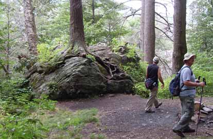 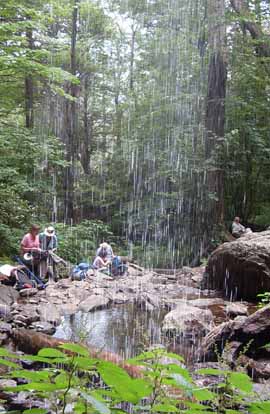
Photos by Lee Silver
WEDNESDAY NO. W1003-543 Aug. 4
Junaluska Gap - London Bald 8:00 AM
Hike 9, Drive 180, 2500 ft. ascent, Rated B-AA
Brent Martin, 828-587-9453, brent_martin@tws.org
W’ll hike around and over London Bald, through a fern-covered forest floor and with views of the Nantahala Ridge spine and Nantahala Lake. The route uses the Junaluska, Diamond Valley, Appletree and London Bald trails along the ridge that separates Macon and Cherokee counties. Second meeting place: Junaluska Gap trailhead at 10:00 AM Topo: Topton; also NatGeo maps #785 & 784
Three people hiked in the Nantahala National Forest on Wednesday August 4th. We took turns leading the hike. We hiked on the London Bald, Junalaska Gap, and Hickory Branch trails. The trails were overgrown and much in need of maintenance. Of course, the trails are not in an area maintained by the CMC. The hike offered beautiful views. We did not follow the hike as it appeared on the Wednesday hike schedule because none of us had been on the trails before. We arrived late from Westgate due to construction traffic and the scheduled hike leader had left. We used a map at a nearby campground to follow the published hike as close as possible. Our hike was 7 miles compared to the scheduled hike of 9 miles.--Jim Arial
WEDNESDAY NO. W1003-665 Aug. 4
MST from NC 128 (Mt. Mitchell Road) to a waterfall and back *10:00 AM
(easy alternate hike)
Hike 6.5, Drive 62, 500 ft. ascent, Rated C-C
Marcia Bromberg, 828-505-0471, mwbromberg@yahoo.com
*Only meeting place: back parking lot at the Folk Art Center. A gentle hike along the MST to a field beyond a lovely waterfall and return. We'll have views along the Blue Ridge Pkwy. on the drive up to Mt. Mitchell Road where the hike begins. Topo: Montreat, Mt. Mitchell.
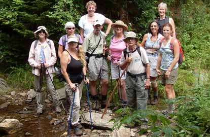
Photo by Marcia Bromberg
Despite a very frustrating drive from the meeting place along the BRP to the trailhead (3 long stops for road work) the 11 hikers who came on the hike enjoyed cool, cloudy weather as they hiked along a flat, easy section of the MST. Lunch was at a small waterfall where some of the hikers remained while the others hiked on another quarter mile to enjoy the views of the valley below and some tasty blueberries. Unfortunately the drive back included 3 more longs stops on the parkway.--Marcia Bromberg
WEDNESDAY NO. W1003-369 Aug. 11
Buckeye Gap - Bearpen Gap *9:00 AM
Hike 6, Drive 80, 1000 ft. ascent, Rated B-B
Bruce Bente, 828-692-0116, bbente@bellsouth.net
P400 *Form carpools at Westgate, and meet leader at BRP Cold Mtn. Overlook at 9:50 AM. We will start by hiking a section of the MST that leads through a lush forest of spruce and birch. The forest floor is covered with mosses and ferns. We will hike through areas that in past years have yielded abundant blueberries and will stop to do some picking. Short car shuttle. Topo: Sam Knob; also NatGeo map #780
Email your hike reports to Dave Wetmore. The deadline for reports is 9:00 p.m. on the Tuesdays before an eNews comes out. Reports for Wednesday hikes during the eNews publication week will appear in the following eNews--The Editor.
--Back to Top
All-day hikes submitted by Bruce Bente 692-0116, bbente@bellsouth.net . Driving distance is round-trip from Asheville. All Saturday and Sunday hikes assemble at Westgate Shopping Center near I-240 UNLESS OTHERWISE NOTED.
Half Day hikes submitted by Lucy Prim 828-693-6580 lucette32@mchsi.com.
Wednesday Hikes are submitted by Charlie Ferguson, 828-398-0213 ccf108@gmail.com and Ann Gleason, 828-859-9387,
gleason.ann@gmail.com .
The meeting place for each hike will be designated by the hike leader and appears in the hike description.
Driving mileage is round trip, based on the first designated meeting place. Meet at Westgate unless otherwise noted. |

